While in Canberra I downloaded an app which will provide me with a simple way of tracing my movements along and around the Merri Creek. I have been worrying about my lack of ability to file this sort of information in any sort of meaningful order, and now I think I will be able to do so with the help of my computer and this app.
Today we took a bike ride down the creek, and along the way we collected Bella Donna (Nightshade). I am able to take photos as I go which are then linked to the map. And I can add photos from my NIR (near infra-red camera) which was a bit tricky, but now I have updated the time and date on the camera, should be a breeze!

Here is a screenshot of my first tracked route along the creek. The little black camera icons are where we stopped and took photos.
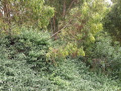
Below are some of the shots, both from my smart phone, and from the converted NRI camera. **
**A special thanks to Graham Nash for giving me his old camera, and even more incredibly for pulling it to pieces, removing the UV filter, and replacing it with a piece of developed colour film. The colour film 'filter' blocks a large proportion of visible light while allowing infra-red rays to pass through.


While these are clearly not stereo images, I wonder if I could get 'almost' stereo images if I took them at the same time, holding the phone and camera side by side? Worth a try.
No comments:
Post a Comment